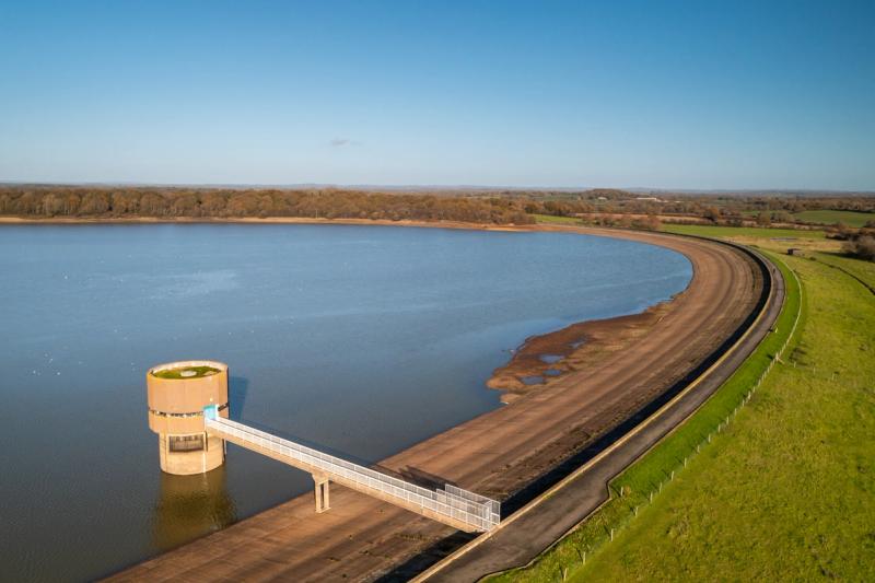
Although Broad Oak Water isn't due to be operational for another decade, we’re carrying out investigation work to gather background data, which will inform the project's development.
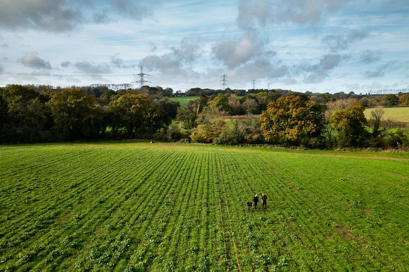
Since April 2024, South East Water staff and our partners have been out and about within the reservoir site and wider East Kent area undertaking environmental, geotechnical, heritage, traffic and amenity surveys.
This ongoing survey work is expected to take several years to complete. Equipment may be placed in trees or on the ground for short durations for some surveys
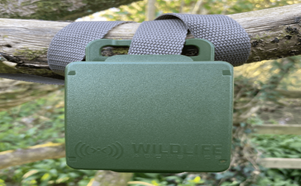
If you do see any equipment, which will be marked with tags or stickers, please leave it where it is. Our teams will remove these as soon as our surveys are complete.


During 2024, our surveys were primarily ecological, with our geological and landscape surveys starting in 2025.
Survey explainers
These investigations cover both the reservoir and pipeline routes, looking at the geology of the ground beneath.
Quick facts
Where we’ll be surveying: Around 150 ‘intrusive’ locations including boreholes, trial and observation pits, and ‘non-intrusive’ geophysical surveys across the reservoir site.
When: July to November 2025.
Why: Boreholes allow us to see the ground profile and identify suitable foundation depths for structures. Observation pits help identify geological hazards. The data collected will be used to build detailed grounds models that will inform our design work.
The hazel dormouse is one of the country’s rarest animals and typically lives in areas of managed woodland.
How will surveys be undertaken?
We’re aware hazel dormice live in nearby woodland, but to understand whether they’re also living on the reservoir site, small nest 'tubes' will be placed in hedgerows, scrub and woodland around the site. These plastic tubes provide a suitable feature for hazel dormice to build nests.
These tubes will be checked monthly by surveyors who are licensed to handle hazel dormice.
Once the surveys are complete, the nest tubes will be removed.
There may be some occasions where surveys may span two years, and nest tubes are left in hedgerows over winter. Please do leave them alone if you spot them.
Quick facts
Where we’ll be surveying: Hedgerows, scrub and woodland habitats. Residential gardens will be avoided.
When: Monthly visits from 2025 between April and November for two to three years.
Visit duration: Each visit will take one day but repeat visits will be required throughout the survey period.
Why: To determine if hazel dormice are using habitats within the site (we’re already aware they live in neighbouring woodland areas).
Equipment: At least 50 nest tubes (black, square section plastic tubes with wooden inserts, see image below) will be placed in scrub, hedgerows and woodland. These will be collected on completion of the survey. All our equipment will be marked with the sticker or tag below so you can easily identify it.
Great crested newts are protected under the Wildlife and Countryside Act and are listed as a European Protected Species.

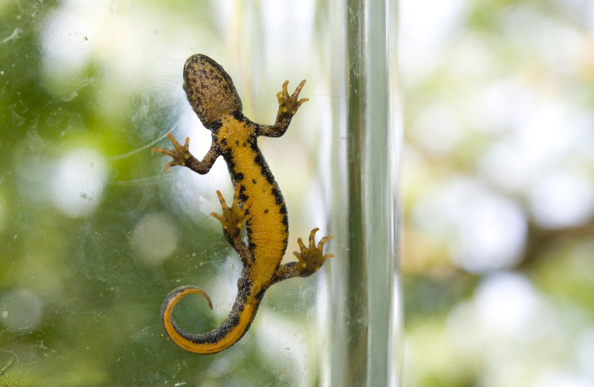
Anyone undertaking surveys on our behalf will hold the appropriate licences.
Surveys will take place between March and mid-June for two to three years and will initially involve daytime visits to take water samples from ponds within or near to our reservoir site.
Water samples will be analysed to check for the presence of great crested newt environmental DNA, and if any is found, further surveys will be needed to determine the size of the newt population. These surveys will take place the following year.
This will involve visits at dusk to set out 'bottle' traps within the ponds, and our surveyors will count newts in the pond using high-powered torches.
Traps will be checked and collected the following morning. Any newts or other amphibians captured will be released immediately.
Quick facts
Where we’ll be surveying: Ponds in and around the Broad Oak Watersite.
When: Between March and mid-June, from 2025 for two to three years.
Why: To understand if there are great crested newts, on or near to the site.
Equipment: Bottle traps and high-powered torches.
Walked surveys will be undertaken across the reservoir site recording birds both seen and heard through birdsong. These surveys will generally take place at dawn, but some will also be done at dusk.
Through this research we’ll be able to identify breeding birds during spring and early summer, those that use the site during winter, or pass through as part of their migration.
Quick facts
Where we’ll be surveying: Farmland, woodland, hedgerow, pasture and grassland on the reservoir site.
When: From 2024 until 2027, with surveys taking place at dawn or dusk. Some will also take place overnight.
Why: To identify the bird species living at the reservoir site.
Equipment: Binoculars with some equipment, such as a Song Meter Micro used from 2026, which will be attached discreetly to a tree or post and left on-site for up to two weeks.

Visual building and tree surveys will be undertaken to understand whether they could be used by a barn owl for breeding or roosting.
If evidence of barn owls is found, we will need to enter the buildings or climb trees to understand how they are using it. These surveys will generally take place between mid-June and August for two to three years.
Quick facts
Where we’ll be surveying: Trees, structures and buildings such as barns or outbuildings. If evidence of barn owls is found internal inspections will be required.
When: From mid-June to August, starting in 2025 for two to three years, with surveys taking place at dusk.
Why: To identify whether barn owls are nesting at the reservoir site.
Equipment: Tree pole-mounted cameras, ladders and binoculars.
We’ll use a variety of survey methods to determine how bats are using the site.

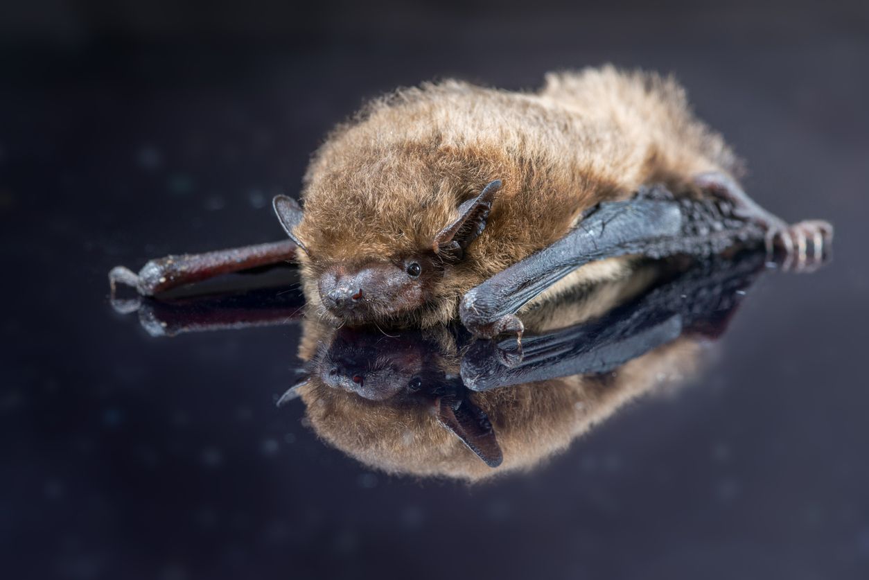
These surveys will involve the use of automated bat detectors set out across the site to record bat echolocation calls. These do not record human speech. These will be set up to record for one week each month, at multiple locations across the site. The data collected will then be analysed to determine which species are present.
We’ll also undertake trapping and radio tracking, in order to determine which bat species are present and where bat roost locations are. This would involve setting up traps at dusk to capture bats. Small electronic tags are attached to bats to track their location. Surveyors may travel on foot or by vehicle to track individual bats as they move around the site or into land nearby.
To determine where bats are roosting, surveys will involve an initial visual inspection of all buildings and trees. Following this, detailed inspections of features may be required and we may need to enter the roof space of buildings or barns and climb trees. Surveys to check for bats emerging from buildings and trees will be undertaken at dusk. Surveyors and recording equipment will be placed in view of potential roost access points to observe and record any bats emerging from the building or trees.
Quick facts
Where we’ll be surveying: Farmland, woodland, hedgerow, pasture, grassland within and next to the reservoir site. We may also need to enter buildings or climb trees to determine roost locations, including residential properties.
When: Surveys are generally undertaken between April and October when bats are active, however, initial assessments of buildings and trees may be undertaken at any time of year. If buildings or trees are considered suitable for hibernating bats, visits to inspect these features during the winter months may be required.
Duration: At least three years.
Why: To determine which species of bat using and roosting on or nearby the site.
Equipment: Automated static bat detectors will be placed at survey locations and locked to trees or posts to record the echolocation calls of passing bats. During potential roost surveys at dusk, surveyors will have recording equipment, including night vision cameras or aids, and thermal imaging or infrared lamps. During trapping, surveyors will set up traps at strategic locations through the night. These will be checked and moved frequently.
These surveys help us understand how river flows change over both the course of a year as well as along a watercourse.
The results of these surveys will enable us to understand how the reservoir may affect flows along the Sarre Penn, how much water can realistically be abstracted from the Great Stour as well as provide us with greater understanding of the Stodmarsh National Nature Reserve.
Quick facts
Where we’ll be surveying: Along the Sarre Penn, its tributaries, Little Stour, Great Stour, Stodmarsh National Nature Reserve andLampen Stream.
When: From 2024 for three years.
Why: The information gathered will be used to help us design the fish pass and bypass channel requirements.
Equipment: A gauge board, instrument housing and buckets as well as a notch weir or flume.
These investigations began in early 2025 and are looking into the listed properties on the site, and potential buried archaeology. We are communicating directly with affected residential on an individual basis.
Geophysical surveys will begin in 2026 followed by trial trenches.
A landscape and visual impact assessment is being undertaken both for the reservoir site and pipeline routes throughout 2025 and into early 2026.
These surveys help us understand how water quality is impacted by the changing river flows over the course of a year.
We will then be able to understand the impact the project will have on the various water courses, data to inform the types of water treatment required within the water treatment works.
Quick facts
Where we’ll be surveying: Various water courses including the Sarre Penn, its tributaries, Great Stour, Little Stour.
When: From April 2025, ongoing for three years.
Fish surveys enable us to understand which species of fish live within a watercourse as well as their population characteristics.
The data will be used to determine baseline situation and inform aspects of reservoir design.
All fish temporarily removed will be returned unharmed to the watercourse immediately after surveys have taken place.
Quick facts
Where we’ll be surveying: The Sarre Penn, Wantsum and Great Stour
When: From 2024, ongoing for three years.
Why: The data will be used to determine the baseline situation and inform aspects of reservoir design.
These surveys help us understand whether there are any notable, protected or invasive species both on the proposed reservoir site and downstream.


Data gathered will also help us design various aspects of the reservoir.
Aquatic invertebrate samples will be sent to a specialist lab so the species can be identified.
Quick facts
Where we’ll be surveying: The Sarre Penn, Sarre Penn’s tributaries and Great Stour
When: From 2024, ongoing for three years.
These surveys help us understand whether there are any notable, protected or invasive species both on the proposed reservoir site and downstream.
Data gathered will also help us design various aspects of the reservoir.
Quick facts
Where we’ll be surveying: The Sarre Penn and Sarre Penn’s tributaries.
When: From 2024, ongoing for three years.
Surveys for reptiles involve setting out small sheets of roofing felt, tin or other material which warm in the sun and provide a safe space for reptiles to bask and shelter. These are checked regularly and the number of reptiles spotted is recorded. These mats remain at survey locations for a number of months.
Quick facts
Where we’ve surveyed: Farmland areas, field boundaries, woodland boundary, areas of grassland and scrub.
When: Between April and October 2025.
Why: To find out which reptile species live at the site.
Frequently asked questions
The majority of surveys are taking place on South East Water owned land, however, there will be instances where we need to survey neighbouring land. When this is needed, we will contact the relevant landowner to discuss what we’d like to do, when and how.
Some, such as bat surveys, may mean we need to enter properties. Again, where this is required, we will contact the property owner or tenant to discuss the survey and arrange a convenient time to undertake the work.
Our teams will cause as little disturbance to landowners and residents as possible.
Yes, our staff and our contractors are fully qualified to undertake this work. Some animals can only be surveyed and, if required, handled by those who hold a special licence, such as a Protected Species Licence with works regulated by Natural England. We ensure all licences are checked and current before anyone begins work.
All staff and contractors undertaking surveys will be carrying a letter on South East Water headed paper explaining what they are doing and who to contact if further information is required.
While we undertake the ecological surveys there will be minimal impact on local roads and footpaths, in fact you may not even see us undertaking this work.
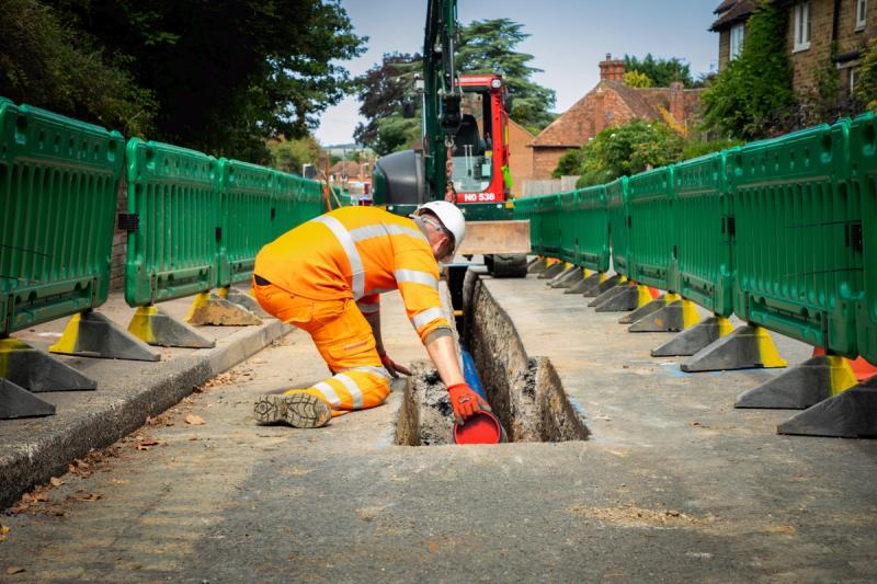
There may be some impact to local footpaths and roads from our geological surveys, but this will be kept to a minimum and fully reinstated when complete.
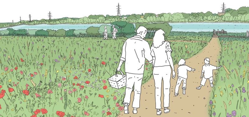
Once we know what species of animals live on the reservoir site following our baseline surveys, as well as the habitats on-site and surrounding areas, we’ll be able to put a comprehensive plan in place to relocate those animals nearby with on-site specialists during works.
We will be putting together a detailed mitigation and enhancement plan, which will take account of those species present, but will also provide enhancements for wildlife areas generally. We can’t say what this will look like yet because we need the data first to inform the best mitigation and enhancements but will share more information when we know more.
The results of the surveys will inform our Environmental Impact Assessment (EIA), which will be reported in the Environmental Statement that will be available to view once our planning application has been submitted. We will also share key interim findings of the EIA process during ongoing public consultation and stakeholder engagement activities prior to submission of the planning application. The data will also be passed to the local Biological Records Centre at regular intervals.